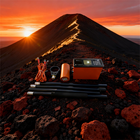
El especialista en procesamiento de datos: desde lecturas sin procesar hasta modelos interpretables
El valor de cualquier estudio geofísico no reside en las mediciones brutas sino en lainterpretaciones procesadasderivados de ellos. Para el especialista en procesamiento de datos, el WCZ-3 es un bienvenido cambio respecto de los instrumentos que producen datos confusos, indocumentados o en formato propietario. Esta versión se centra en cómo el WCZ-3 simplifica y agiliza el proceso de procesamiento, permitiendo más tiempo para la interpretación y menos para la limpieza de datos.
Limpiar datos desde el principio– El WCZ-3evaluación de calidad en tiempo realgarantiza que los datos que llegan a la mesa de procesamiento ya hayan sido examinados en el campo. La puntuación de calidad (0-10) se registra para cada estación; el especialista puede filtrar las mediciones con puntuación baja al inicio del procesamiento. Esta preselección elimina la necesidad de una laboriosa detección manual de valores atípicos. Elregistro de temperaturayIndicadores de calidad de fijación GPSProporcionan contexto adicional para identificar lecturas sospechosas, como las tomadas durante la degradación de la geometría de un satélite.
Metadatos completos en un formato utilizable– Cada registro de medición contiene: marca de tiempo UTC, campo magnético (nT), latitud, longitud, elevación, puntaje de calidad, temperatura y recuento de satélites/PDOP GPS. Elformato de texto CSVes directamente importable a cualquier entorno de procesamiento geofísico. El especialista puede utilizar scripts Python (Pandas, ObsPy), R o paquetes comerciales (Oasis montaj, Geosoft) sin ninguna herramienta de conversión. Elorden de columnas estandarizadoyFormato de hora ISO 8601facilitar los flujos de trabajo automatizados.
Corrección diurna hecha sistemática– El WCZ-3Reloj disciplinado por GPSGarantiza que las lecturas de la estación base y del móvil compartan una referencia horaria común. El software incluido realizacorrección diurna automatizadahaciendo coincidir las marcas de tiempo de la encuesta móvil con la serie de tiempo de la estación base. El especialista también puede exportar los datos de la estación base a un archivo externo para utilizarlos en algoritmos de corrección alternativos (por ejemplo, utilizando datos de un observatorio magnético regional). El software conserva los valores brutos y corregidos, lo que permite al especialista evaluar el impacto de la corrección.
Cuadrícula y continuación– El software proporciona múltiples algoritmos de cuadrícula: curvatura mínima, kriging y ponderación de distancia inversa. El especialista puede elegir el método que mejor se adapte al muestreo espacial de la encuesta. El software también admitecontinuación hacia arriba y hacia abajopara estimación de profundidad y separación de tendencias. Elgeneración de mapas de contornoIncluye niveles personalizables, paletas de colores y opciones de etiquetado adecuadas para su publicación.
Extracción y modelado de perfiles– Para anomalías lineales (por ejemplo, diques, fallas, tuberías), el software puede extraer perfiles a lo largo de cualquier línea definida por el usuario. Estos perfiles se pueden exportar a software de modelado avanzado (por ejemplo, ModelVision, Potent) para probar hipótesis geológicas. Eldeconvolución de Euleryseñal analíticaLas funciones proporcionan estimaciones iniciales de la profundidad de la fuente, lo que guía un modelado más detallado.
Informes de control de calidad– El software puede generar uninforme de control de calidadresumiendo: estaciones totales, estaciones rechazadas (por umbral de puntuación de calidad), estadísticas de espaciamiento de estaciones, deriva de estaciones base y magnitud de corrección diurna. Este informe es esencial para la documentación del proyecto y los entregables del cliente. El informe se genera como un PDF con tablas y gráficos integrados, listo para su inclusión en los informes finales.
Procesamiento por lotes para grandes conjuntos de datos– Los estudios con cientos de miles de estaciones (comunes en vehículos aéreos no tripulados o estudios terrestres a gran escala) requieren un procesamiento por lotes eficiente. El software WCZ-3 admitemodo por lotes de línea de comandos, permitiendo el procesamiento automatizado de múltiples archivos. El especialista puede configurar un flujo de trabajo de procesamiento que se ejecute durante la noche y entregue resultados de cuadrícula y contornos por la mañana.
Archivado a largo plazo– Los archivos CSV sin formato se describen a sí mismos y no requieren ningún lector propietario. El especialista puede archivar los datos en un repositorio seguro, con la confianza de que seguirán siendo legibles durante décadas. Elintegridad de los metadatosTambién garantiza que el reprocesamiento futuro (por ejemplo, después de mejoras en los modelos de corrección diurna) se pueda realizar sin revisar las notas de campo.
Para el especialista en procesamiento de datos, el WCZ-3 no es sólo un instrumento; es unfuente de datos con buen comportamientoque encaja perfectamente en los flujos de trabajo de computación geofísica modernos, minimizando el tiempo dedicado a la manipulación de datos y maximizando el tiempo disponible para la interpretación geológica.


 ¡Su mensaje debe tener entre 20 y 3.000 caracteres!