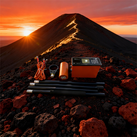
logo
Chongqing Gold Mechanical & Electrical Equipment Co.,Ltd
電子メール: master@hy-industry.com 電話番号: 0086-159-2263-6015
> プロダクト > 磁気調査の器械 >
Subsurface Magnetic Sensor Archaeological Magnetometer
  • Subsurface Magnetic Sensor Archaeological Magnetometer
  • Subsurface Magnetic Sensor Archaeological Magnetometer
  • Subsurface Magnetic Sensor Archaeological Magnetometer
  • Subsurface Magnetic Sensor Archaeological Magnetometer
  • Subsurface Magnetic Sensor Archaeological Magnetometer
  • Subsurface Magnetic Sensor Archaeological Magnetometer
  • Subsurface Magnetic Sensor Archaeological Magnetometer

Subsurface Magnetic Sensor Archaeological Magnetometer

起源の場所 重慶、中国
ブランド名 Gold
証明 ISO9001 CCC CE
モデル番号 WCZ-3
プロダクト細部
製品名:
磁気調査の器械
正確さ:
0.5/ 1nT
許可される勾配:
5000 / 8000 Nt/m
使用法:
地磁気分野の調査
インタフェース:
RS-232Cの標準的なシリアル ポート
寸法:
206*85*155mm、1.5kg
測定範囲:
20000nT~100000nT
解決:
0.1 / 0.05nT
ハイライト: 

subsurface magnetic sensor for archaeology

,

archaeological magnetometer survey instrument

,

magnetic sensor with subsurface detection

製品の説明

The Data Processing Specialist – From Raw Readings to Interpretable Models

The value of any geophysical survey lies not in the raw measurements but in the processed interpretations derived from them. For the data processing specialist, the WCZ-3 is a welcome departure from instruments that produce messy, undocumented, or proprietary-format data. This version focuses on how the WCZ-3 simplifies and streamlines the processing pipeline, allowing more time for interpretation and less for data cleaning.

Clean Data from the Start – The WCZ-3’s real-time quality assessment ensures that the data arriving at the processing desk have already been vetted in the field. The quality score (0-10) is recorded for each station; the specialist can filter out low-scoring measurements at the start of processing. This pre-screening eliminates the need for laborious manual outlier detection. The temperature log and GPS fix quality indicators provide additional context for identifying suspect readings, such as those taken during a satellite geometry degradation.

Complete Metadata in a Usable Format – Each measurement record contains: UTC timestamp, magnetic field (nT), latitude, longitude, elevation, quality score, temperature, and GPS PDOP/satellite count. The CSV text format is directly importable into any geophysical processing environment. The specialist can use Python scripts (Pandas, ObsPy), R, or commercial packages (Oasis montaj, Geosoft) without any conversion tool. The standardized column ordering and ISO 8601 time format facilitate automated workflows.

Diurnal Correction Made Systematic – The WCZ-3’s GPS-disciplined clock ensures that base station and mobile readings share a common time reference. The included software performs automated diurnal correction by matching the mobile survey’s timestamps to the base station’s time series. The specialist can also export the base station data to an external file for use in alternative correction algorithms (e.g., using a regional magnetic observatory data). The software retains both raw and corrected values, allowing the specialist to assess the correction’s impact.

Gridding and Continuation – The software provides multiple gridding algorithms: minimum curvature, kriging, and inverse distance weighting. The specialist can choose the method best suited to the survey’s spatial sampling. The software also supports upward and downward continuation for depth estimation and trend separation. The contour map generation includes customizable levels, color palettes, and labeling options suitable for publication.

Profile Extraction and Modeling – For linear anomalies (e.g., dykes, faults, pipelines), the software can extract profiles along any user-defined line. These profiles can be exported to forward modeling software (e.g., ModelVision, Potent) to test geological hypotheses. The Euler deconvolution and analytic signal functions provide initial source depth estimates, guiding more detailed modeling.

Quality Control Reports – The software can generate a QC report summarizing: total stations, rejected stations (by quality score threshold), station spacing statistics, base station drift, and diurnal correction magnitude. This report is essential for project documentation and client deliverables. The report is generated as a PDF with embedded tables and graphs, ready for inclusion in final reports.

Batch Processing for Large Datasets – Surveys with hundreds of thousands of stations (common in UAV or large-scale ground surveys) require efficient batch processing. The WCZ-3 software supports command-line batch mode, allowing automated processing of multiple files. The specialist can set up a processing workflow that runs overnight, delivering grid and contour outputs by morning.

Long-Term Archiving – The raw CSV files are self-describing and require no proprietary reader. The specialist can archive the data in a secure repository, confident that it will remain readable for decades. The metadata completeness also ensures that future re-processing (e.g., after improvements in diurnal correction models) can be performed without revisiting field notes.

For the data processing specialist, the WCZ-3 is not just an instrument; it is a well-behaved data source that fits seamlessly into modern geophysical computing workflows, minimizing the time spent on data wrangling and maximizing the time available for geological interpretation.


Data-Processing-Focused Specification Benefit for Specialist
CSV Output with Full Metadata Direct import to any software
Quality Score per Station Objective filtering of suspect data
GPS-Disciplined Time Diurnal correction with millisecond accuracy
Included Software Gridding, contouring, continuation, Euler deconvolution
Batch Processing Mode Automated processing of large surveys
QC Report Generation Documentation for client deliverables
Raw + Corrected Data Retention Allows assessment of correction effects
Open Format for Long-Term Archive No proprietary lock-in
Compatibility Oasis montaj, Surfer, ArcGIS, Python, R


Subsurface Magnetic Sensor Archaeological Magnetometer 0

Subsurface Magnetic Sensor Archaeological Magnetometer 1

Subsurface Magnetic Sensor Archaeological Magnetometer 2

Subsurface Magnetic Sensor Archaeological Magnetometer 3

私達にいつでも連絡しなさい

0086-159-2263-6015
1F 技術ビル,ロングシン工業公園,南安地区,重慶 中国
私達にあなたの照会を直接送りなさい