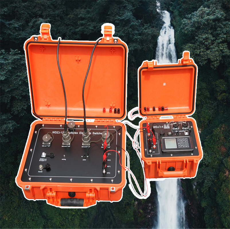
Protección de los Activos Críticos de la Nación: WGMD-4 para Infraestructura de Defensa y Seguridad
La infraestructura de defensa nacional —bases militares, astilleros navales, aeródromos, silos de misiles, instalaciones de comunicaciones seguras e instalaciones de seguridad fronteriza— representa una categoría de activos donde el fallo no se mide en dólares, sino en seguridad nacional comprometida y vidas perdidas. Estas instalaciones deben operar bajo condiciones extremas, resistir ataques deliberados y mantener su funcionalidad cuando la nación más las necesita. El Sistema de Inteligencia para Infraestructura de Defensa WGMD-4 está diseñado según los exigentes estándares requeridos para estos activos críticos. Proporciona precisión absoluta de ±1% en la caracterización de las condiciones geotécnicas y geoambientales que sustentan su resiliencia, al tiempo que ejerce 900V de potencia de interrogación profunda para detectar amenazas y vulnerabilidades ocultas. Sirve como la herramienta definitiva para ingenieros militares, planificadores de seguridad y contratistas de defensa encargados de garantizar que las instalaciones más sensibles y vitales de la nación se asienten sobre un terreno sólido como una roca y completamente comprendido.
Ubicación de Búnkeres e Instalaciones Reforzadas: El Requisito Fundamental de la Base
Las instalaciones reforzadas diseñadas para resistir bombardeos aéreos, impactos terrestres o ataques químicos/biológicos imponen demandas sin precedentes al terreno subyacente. La estructura debe transferir cargas dinámicas extremas a la tierra sin fallos catastróficos. El WGMD-4 proporciona la inteligencia del subsuelo requerida para una ubicación óptima. Mapea la profundidad hasta el lecho rocoso competente, identifica zonas de material uniforme y de alta resistencia, y delimita cualquier fractura o zona débil que pueda concentrar tensiones bajo cargas de explosión. Su modelo 3D con precisión de ±1% permite a los ingenieros de defensa posicionar la instalación para maximizar las características protectoras de la geología natural, reduciendo la cantidad de hormigón armado requerido y aumentando la capacidad de supervivencia de la instalación. Para activos reforzados existentes, el WGMD-4 puede utilizarse para evaluaciones de vulnerabilidad, escaneando el terreno circundante en busca de posibles vectores de amenaza como túneles u objetos explosivos sin detonar.
Cinco Aplicaciones Críticas de Defensa y Seguridad
Supervivencia y Reparación de Pistas y Calles de Rodaje de Bases Aéreas: En un conflicto, las pistas de las bases aéreas son objetivos primarios. La capacidad de reparación rápida es esencial. El WGMD-4 proporciona la caracterización geotécnica de referencia que informa tanto la construcción inicial como la planificación de reparaciones. Al mapear las condiciones del subsuelo con precisión, permite el diseño de pistas con una capacidad de carga conocida y consistente. En caso de daños, estos datos preexistentes permiten a los ingenieros evaluar rápidamente la extensión de la perturbación del subsuelo por el impacto de una bomba y diseñar una reparación apropiada y efectiva, poniendo las aeronaves en el aire más rápido.
Integridad Geotécnica de Astilleros Navales y Bases de Submarinos: Los astilleros que manejan las embarcaciones más grandes de la flota requieren diques secos masivos, rieles de grúa y plataformas de elevación pesada. El asentamiento diferencial puede inutilizar un dique seco o desalinear sistemas de rieles críticos. El WGMD-4 proporciona el modelo geotécnico continuo para estas instalaciones, identificando zonas que requieren soporte de cimentación profunda y asegurando que todas las estructuras de carga estén fundadas en un terreno que no se asiente diferencialmente. Esto protege la capacidad de la nación para mantener, reparar y desplegar sus activos navales.
Selección y Monitoreo de Sitios de Instalaciones de Comunicaciones Seguras: Las instalaciones de comunicaciones estratégicas y de mando y control de la nación requieren estabilidad y seguridad absolutas. El WGMD-4 ayuda en la selección del sitio al identificar ubicaciones con bajo ruido de fondo natural(importante para estaciones receptoras sensibles) y con geología resistente a túneles u otras intrusiones subterráneas. Para instalaciones existentes, puede desplegarse para escaneos de seguridad periódicos, detectando cualquier actividad subterránea no autorizada, como la excavación de un túnel, que pueda comprometer la instalación.
Verificación de Cimentaciones de Silos de Misiles y Complejos de Lanzamiento: Los silos de misiles balísticos intercontinentales representan lo último en infraestructura reforzada, diseñados para resistir efectos nucleares de impacto cercano. El WGMD-4 se utiliza durante la verificación de la construcción para garantizar que el terreno circundante al revestimiento del silo cumpla con las especificaciones precisas y uniformes de capacidad de carga requeridas para que la estructura sobreviva a impactos de tierra extremos. Después de la construcción, puede utilizarse para monitoreo a largo plazo para detectar cualquier cambio en las propiedades del terreno que pueda afectar el rendimiento.
Evaluación de Infraestructura de Seguridad Fronteriza: Los muros fronterizos, las barreras para vehículos y las torres de vigilancia solo son tan efectivos como sus cimentaciones. El WGMD-4 proporciona los datos geotécnicos necesarios para diseñar estas estructuras para resistir socavaciones, arrastres o intentos deliberados de brecha. También puede utilizarse para mapear posibles túneles de contrabando o detectar vacíos debajo de las barreras, proporcionando a las agencias de seguridad fronteriza inteligencia procesable para cerrar estas vulnerabilidades.

Tabla de Especificaciones de Infraestructura de Defensa
El Imperativo de la Seguridad Nacional: El Conocimiento es Protección
Para la infraestructura de defensa, el costo de la ignorancia geotécnica se mide en misiones comprometidas y vidas perdidas. El WGMD-4 proporciona el conocimiento fundamental que protege estos activos críticos. Asegura que las bases aéreas de miles de millones de dólares se construyan sobre un terreno que no fallará cuando la nación más las necesite. Verifica que los silos reforzados puedan cumplir su misión disuasoria definitiva. Proporciona la inteligencia para detectar y contrarrestar amenazas subterráneas a la seguridad nacional. En la más exigente de estas aplicaciones, el WGMD-4 no es solo un instrumento geofísico; es un componente esencial de la infraestructura de defensa nacional, que proporciona la certeza del subsuelo de la que depende la seguridad de la nación.

 ¡Su mensaje debe tener entre 20 y 3.000 caracteres!